


Mis à jour le
Book your stay
The Verdon River rises between the Col d’Allos in the Southern Alps and the summit of Trois-Évêchés in Alpes-de-Haute-Provence. After a journey of more than 165 kilometres, it flows into the Durance near the Var village of Vinon-sur-Verdon.
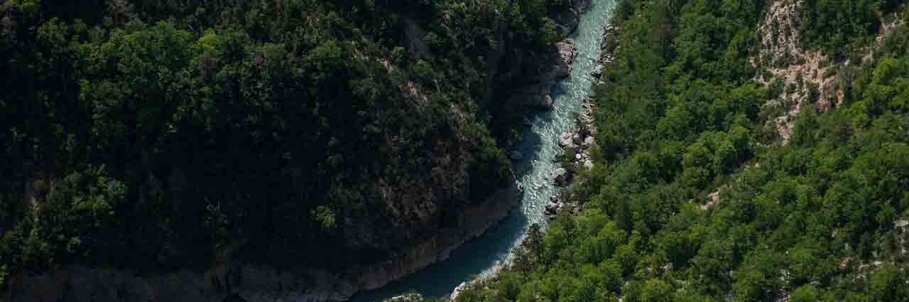
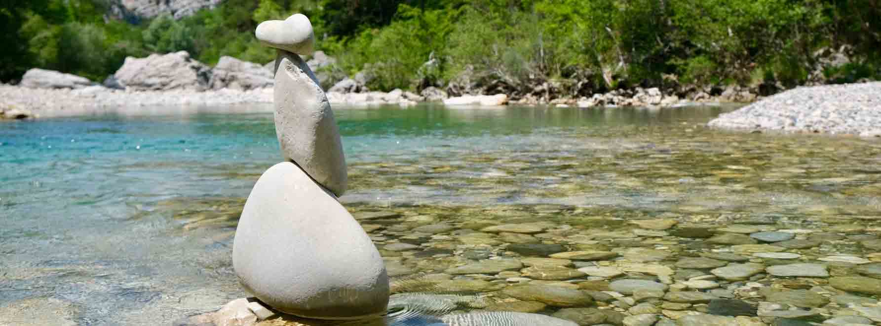
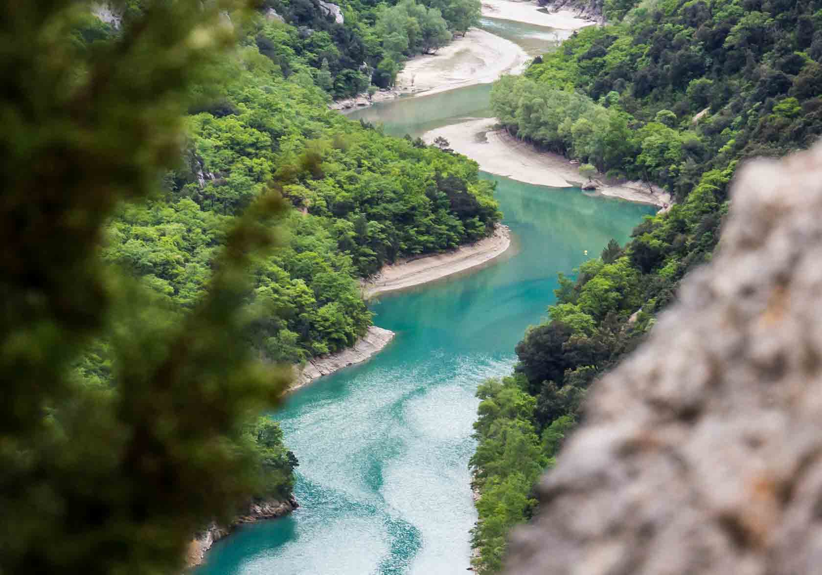
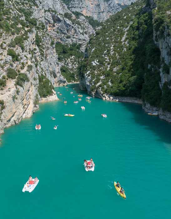
Near Castellane, the Verdon has carved out the breathtaking landscapes of Europe’s most beautiful canyon. The river takes its name from its distinctive colour, a blue-green hue ranging from the palest turquoise to the deepest emerald, depending on the clay-rich riverbed or, in some areas, the presence of microalgae.
Initially a fast-flowing mountain torrent, the Verdon drops from over 2,000 metres above sea level to just 900 metres in only 45 km. Fed by several tributaries, it then crosses major mountain ranges where it has carved the magnificent gorges for which it is famous. Dotted with several hydroelectric dams, these gorges are also linked by reservoirs: Sainte-Croix, Esparron, Quinson, Castillon, Chaudanne. A true natural gem, the Verdon Gorges are classified as a Grand Site de France. They are inseparable from Lake Sainte-Croix and the Pont de Galetas, from which the entrance to the gorges can be explored by canoe, pedal boat and electric boat.
In a mountain environment influenced by the Mediterranean climate, the Verdon Gorges enjoy a humid microclimate and mild temperatures. The high humidity encourages the growth of lush vegetation, very different from the flora found on the plateaus and summits surrounding the river.
The power of the Verdon, a torrential river descending from the Trois-Évêchés massif, is harnessed by several hydroelectric dams built during the 20th century, between the Second World War and the 1970s: the Chaudanne and Castillon dams upstream of the canyon, then the Sainte-Croix, Esparron and Quinson dams after the gorges. The Lake Sainte-Croix project is the one that most dramatically reshaped the valley landscape, as it led to the submergence of the village of Salles-sur-Verdon, which was rebuilt on higher ground.
Part of the Verdon’s waters flow towards the Durance after Vinon-sur-Verdon, while another part supplies Marseille and other coastal towns with water.
Throughout its journey between the Southern Alps and the Durance, the Verdon is fed by many tributaries, including the Artuby and the Baou, which join it in the gorges. Its flow rate varies considerably depending on the season and weather conditions: from 1.5 m3 per second to 15 m3 per second. An exceptional flow of 1,000 m3 per second was recorded in 1994, causing a devastating flood.
The Triassic geological period was marked by the sea covering Provence. Thick layers of limestone then formed in its depths. During the Jurassic, this sea was shallow and warm, which favoured the development of corals. The sea retreated during the Cretaceous, due to the uplift of Provence. During the Tertiary era, the Alps formed, pushing the sea even further south. Jurassic limestone fractured, gradually shaping the region’s relief. The Verdon began to carve its riverbed. Quaternary glaciations amplified erosion by turning waterways into rivers and lakes of ice. The turbulent flow of the Verdon, at the end of the glaciations, continued to carve deeper until it reached the coral and limestone sediments that had formed during the Secondary era.
The Verdon River and the Verdon Natural Park offer many opportunities for water-based activities and walking routes along trails to discover Moustiers-Sainte-Marie and Gréoux-les-Bains. Visiting the Verdon Gorges, its regional natural park, the Valensole plateau or the lower Verdon gorges are other must-do activities in the Provence-Alpes-Côte d’Azur region.
Mis à jour le