

Hikes Starting from the Campground
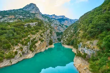
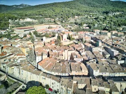
Set out on a hike from the campground and discover a stunning setting rich in cultural heritage. Three pleasant hikes starting from the campground let you explore the chapels around the village of Aups, take in the olive groves—often arranged in terraces—the small stone walls, and the Mediterranean flora. These hikes offer a lovely view of the village of Aups, the plains, and the Espiguières mountain.
The Caves Trail
About 1 to 2 hours – 2 km
Starting at the tourist office, walk past St. Pancras Church and continue on to the Clock Tower. Take Rue des Aires and exit the ramparts through the Porte des Aires. Continue past the Notre-Dame de la Délivrance Chapel and cross the street to reach Chemin des Devensaux.
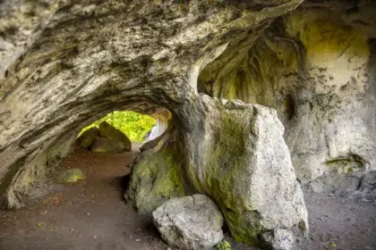
At 150 m, take the Trinité trail on the right leading up to the Sainte Trinité Chapel, walk downhill, and follow the dirt path to reach the first caves of Aups.
Read more
Continue along this path to reach the Sainte Magdeleine Chapel. Then continue on to the intersection with the Chemin de la Croix des Pins.
Continue along the slightly sloping path to the right, next to the low walls. When you reach a small road, continue downhill to the Gervasoni oil mill and head straight to the campground across the street.
The Cross of the Pines
About 3½ to 4 hours – 11.5 km
Follow the same path as the Caves Trail until you reach the intersection with the Croix des Pins Trail. Turn left. The path climbs up a small wooded hill that leads to a trail through the forest. Turn right. The trail heads east and, after 1 km, reaches a shortcut (a steep little path that leads more quickly to the Croix des Pins). Continue along the trail for about 1 km until you reach a cistern and, right next to it, the intersection with the Grande Colle trail. Follow this trail to the left until you reach the Col de Brès.
Read more
Just above that, follow the trail that climbs to the left. The climb is about 800 m to the summit of Montagne des Espiguières. The trail continues across the plateau to a water tank (about 1 km away). A path branches off to the left into the woods and provides a quicker route to the Croix des Pins.
Return to the trail and continue on your way. The trail winds through the forest and, after 1.7 km, reaches the Croix des Pins forest road. Turn right. After 800 m, you’ll come to the Devensaux trail. Return to the village via this trail. Continue along the road until you reach the outskirts of Aups. Return to the starting point through the village’s narrow streets.
Above Aups, via La Perière
About 2½ hours – 7.5 km
Starting at the tourist office, walk past St. Pancrace Church and continue to the Clock Tower. Take Rue des Aires and exit the ramparts through the Porte des Aires. Continue past the Notre-Dame de la Délivrance Chapel and follow Avenue Victor Maria ( D957), which ends at Avenue Albert 1er. Just before the bridge, take the small paved road, Chemin de la Grave, on the right. Continue for about 400 meters, and at the intersection, turn left onto Chemin de la Peirière and follow it for about 1 kilometer.
At the intersection, turn right onto the Chemin de la Croix des Pins. Pass the Estré guesthouse and continue to the water tank (intersection), where you should turn right onto the narrow trail as if you were heading back toward the village. At the next fork in the road, do not take the Chemin des Devansaux to the right; instead, take the trail on the left toward Croix des Pins. Continue south until you reach a four-way intersection.
Read more
Do not take the path marked in yellow; instead, take the trail on the right toward “Citerne 25 m3.” At the water tank, take the trail on the left and continue for about 1 km. In the middle of a wide bend, take a small path that continues to the right and is marked in yellow on a tree. (Be careful not to miss the start of this path.) Continue along this small path, then turn right and climb up the trail marked in yellow: “Grottes de Sainte-Magdeleine.”
Then continue along the trail, passing by the caves and the rock chapel, and a little further on to the right, the Sainte-Trinité Chapel. At the end of the paved path, take the trail directly across from it. Turn left onto Chemin des Devansaux. Once you reach Avenue Victor Maria, turn left until you reach the roundabout at the middle school. Go through the Portail des Aires, then take Rue des Aires, passing by the Clock Tower and then Saint Pancrace Church, to return to the starting point at the tourist office.